• Home
  • News
  • About
  • Privacy
  • Contact

All About Fraser Island

Everything a visitor needs to know

  • About Fraser
    • Fraser Island Facts
  • Island Attractions
    • Towns
      • Orchid Beach
      • Kingfisher Bay
      • Eurong Beach
      • Cathedral Beach
      • Happy Valley
      • Dilli Village
    • Beaches
    • Rainforest
    • Lakes
    • Creeks
  • Barges & Ferry
    • Barges at Inskip Point
    • Ferry from River Heads
  • Accommodation
    • Hotels and Resorts
    • Private Holiday House Rentals
      • Footsteps on Fraser – Orchid Beach
    • Caravan And Camping
      • Waddy Point Campgrounds
      • Dundubara Camping Area
      • Wathumba Camping Grounds
  • 4WD Driving
    • 4WD Vehicle Preparation
    • 4WD Sand Driving Tips
    • Best Tyre Pressure For Sand
    • Fraser Island Driver Etiquette
  • Fishing
    • Beach, Rock, Reef & Estuary
    • Finding Pipis
    • Beach Worms
    • Mud Crabs
You are here: Home / Featured / Map Of Fraser Island

Map Of Fraser Island

September 19, 2014 by Rusty

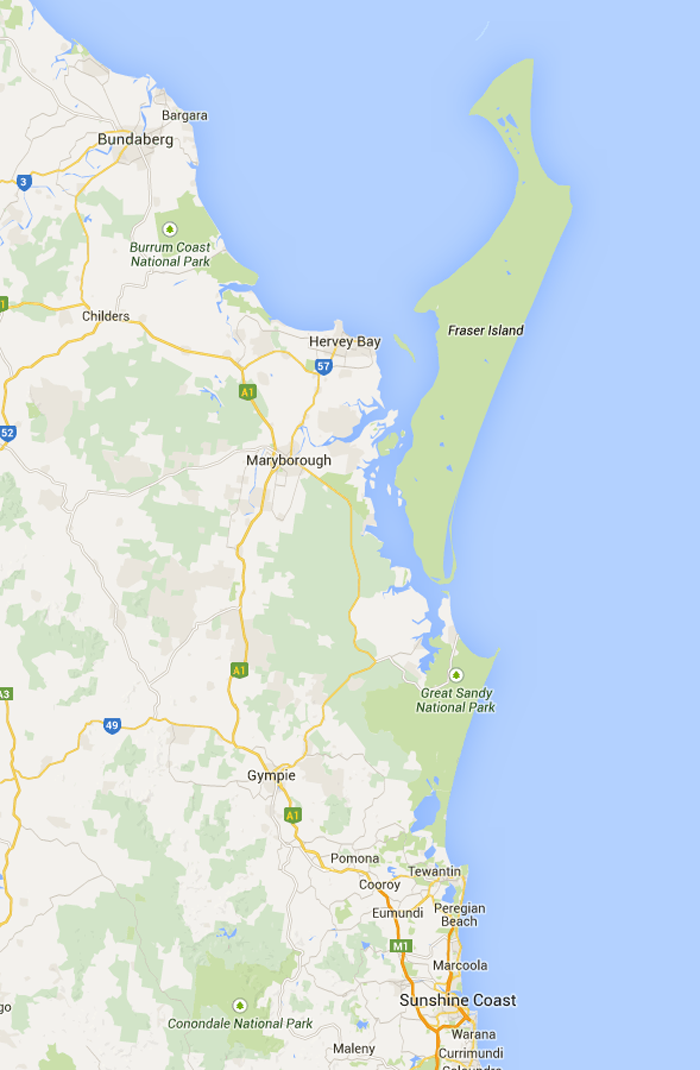
World Heritage listed Fraser Island is the largest sand island in the world. So when we talk about certain places you will see exactly where they are on the island. We hope this map will assist you in navigating the island.

It’s easy to use. Just scroll with your mouse or pinch on your mobile device, to zoom in on the attractions we are mentioning.

That way you can get a birds eye view.


The Map Will Show You

 Townships On The Island

  • Dilli Village
  • Eurong
  • Happy Valley
  • Cathedral Beach
  • Orchid Beach

The Popular Tourist Spots

  • Maheno shipwreck
  • Eli Creek
  • Lake Mackenzie
  • Central Station
  • Indian Head
  • Champagne Pools
  • The Coloured sands

Some Accommodation Options On The Map

  • Managed Campgrounds
  • Resorts
  • Popular Holiday Homes
map-of-fraser-zoomed

ADVERTISEMENT

Fraser Island T-Shirts

Fraser Island T-Shirt

Find More Fraser Tees

map-of-fraser

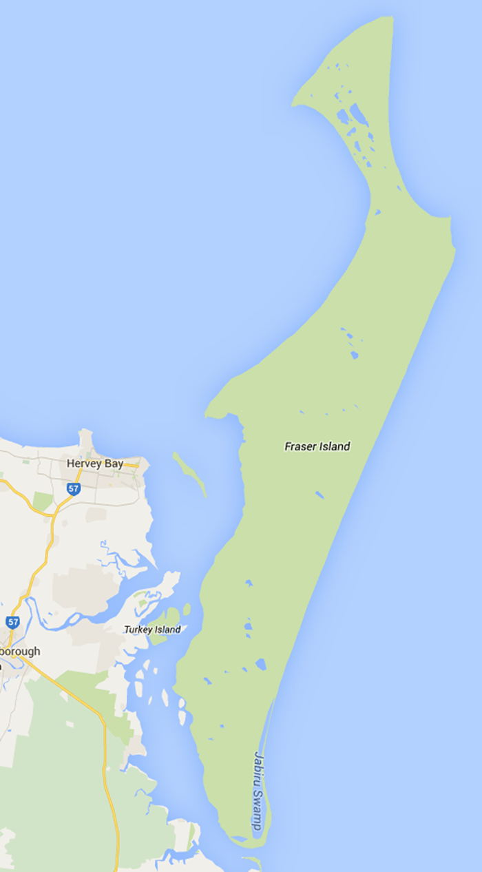
More (K’gari) Fraser Island Lakes to Visit

  • Lake Wabby
  • Ocean Lake
  • Lake McKenzie
  • Lake Birrabeen
  • Lake Boomanjin
  • Lake Allom
  • Eli Creek

Map of Fraser Island

map of fraser island

Filed Under: Featured Tagged With: attractions, beach, Eurong, Fraser Island, map, The Cape, Tourists

A Little About Us

Kids and sandboarding – awesome fun on Fraser Dunes

We are the Boston family. Rusty, Ursula and our 2 daughters Summer & Lotus. We are long time residents of the island and have lived at Orchid Beach for more than 20 years...
Read More…

Latest Articles

Barge

Driving Times From Inskip Point to Orchid Beach on Fraser Island Australia

A very common question that everyone asks is how long it takes to get to Orchid Beach. The short answer depends! Depends on the weather, the tide and the driving condition, more about that later. A … [Read More...]

  • How Long Is The Drive From Hook Point to Orchid Beach?
  • Fraser Island Fishing – Beach, Rock, Reef & Estuary Extreme Island Fishing on Fraser
  • All About Camping on Fraser Island : How To Get the Best Experience With All (K’gari) Fraser Island Camping Grounds
  • Fraser Island Weather – Monthly Climate and Seasonal Conditions For The Best Time To Visit
  • Can You Go To Fraser Island Without a 4WD?
  • Driving The Wathumba Creek Track – Towing a Boat Fraser Fishing
  • Fraser Island Sand Dunes – Sand Boarding is Awesome Fun for Kids
  • Waddy Point Campgrounds – Beachfront Camping Area Fraser Island
  • Wathumba Creek – A Top Fishing Spot On Fraser Island That Offers Everything

Map Of Fraser Island

map-of-fraser

Looking For Something?

Copyright © 2023 All About Fraser All rights Reserved